If you can’t translate geospatial risk into dollars, how are you really pricing?
SpatialKey brings geospatial insight and financial impact into everyday workflows so insurers can act faster, price smarter, and see risk clearly without leaving their core systems.


Your biggest risk might be how long
it takes to get answers
Insurers often rely on disconnected systems and require specialized skillsets to measure risk and understand exposure. SpatialKey embeds financial impact with visualizations directly into workflows so teams gain clarity without delays, extra tools, or additional headcount.
SpatialKey by the numbers
00%
faster risk assessment
0%
lower claims cost
00%
faster quoting
00%
less time spent on portfolio analysis
Turn underwriting decisions into
financial advantages
SpatialKey gives underwriters the clarity they need, when they need it by embedding high-value data and visual analytics directly into underwriting and quoting workflows. Reduce loss ratios and grow your business with risk intelligence that lives where work already happens.
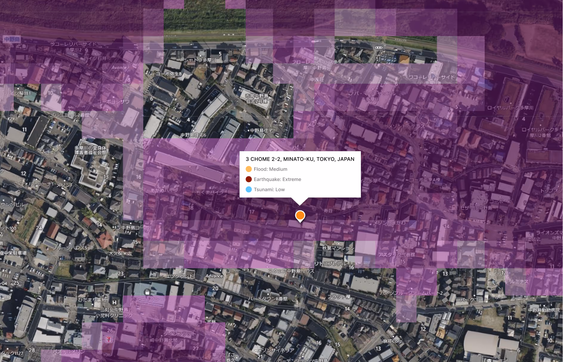
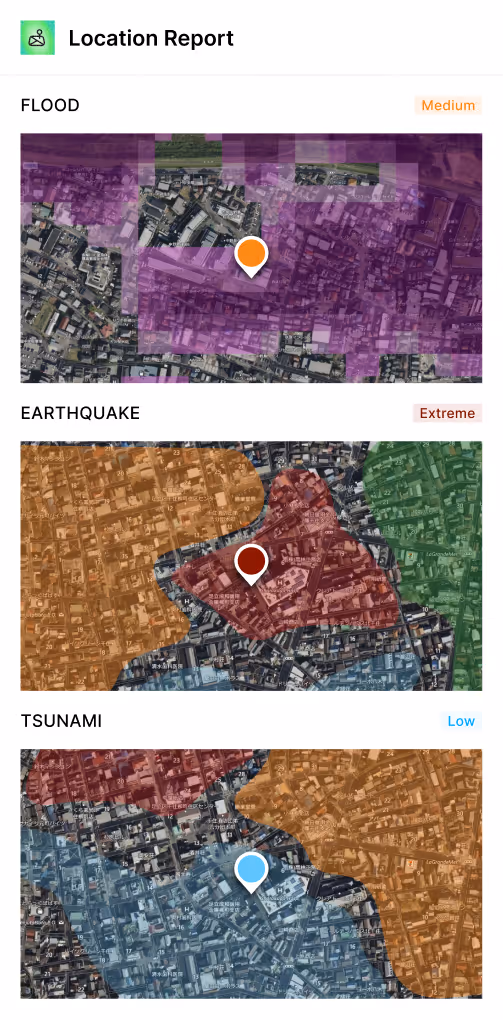
Price policies with financial clarity
Translate location-based risk into clear dollar impact so underwriters can price confidently and protect profitability
Visualize potential hazards
Make smarter underwriting decisions with real-time data from over 70 industry-leading partners
Assess more risks faster
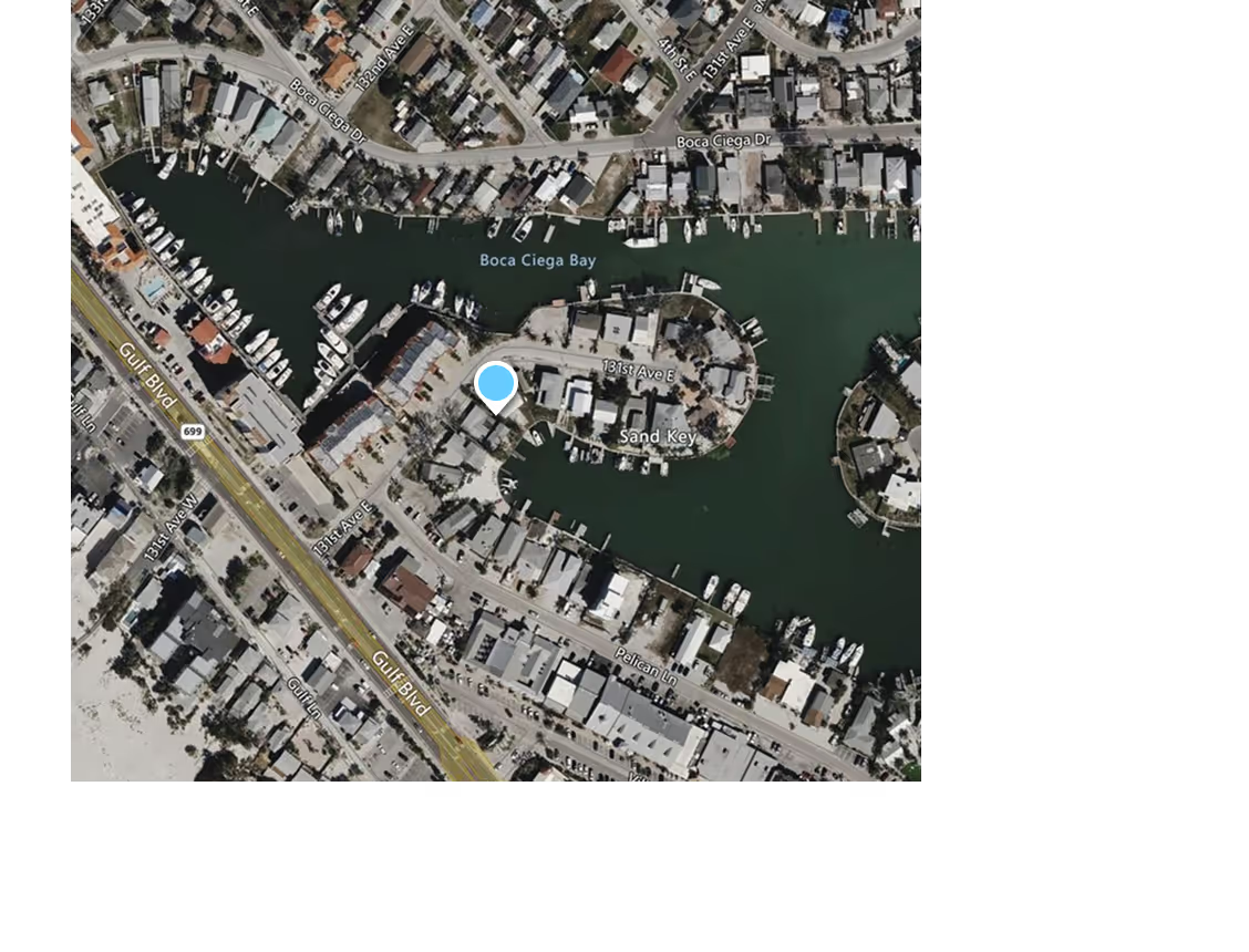
Analyze location-specific risk and portfolio concentrations in a single, interactive environment

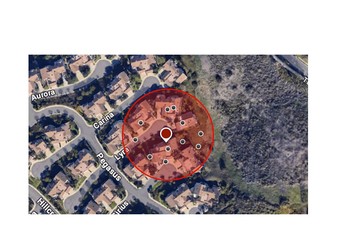
Spot financial risk before it strikes
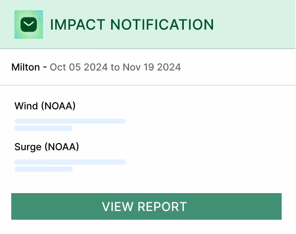
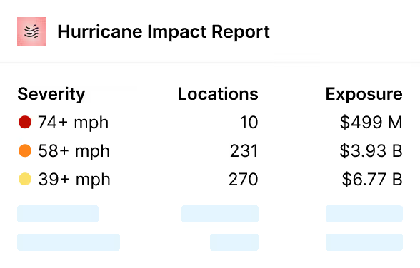
SpatialKey proactively controls your aggregation exposure through built-in moratorium logic and active weather event triggers. Stay ahead of impactful weather events and confidently manage accumulation risks at the location and policy level.
Understand risk across portfolios and perils
Actively manage capacity in high‑hazard areas, prevent over‑concentration across lines and regions, and keep new business aligned with your risk appetite and reinsurance strategy
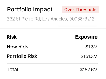
Respond to severe weather events in real time
Automated event alerts based on your settings and exposure analytics help teams quickly understand portfolio impact and prioritize actions
Shield portfolios and support policyholders
Identify affected insureds early and take proactive action to reduce claims costs and strengthen customer relationships
Simplify complex risk analysis with AI
SpatialKey uses AI to make advanced geospatial analysis easy to understand and scalable across teams, eliminating long implementations, heavy IT dependency, and the need for scarce GIS expertise.
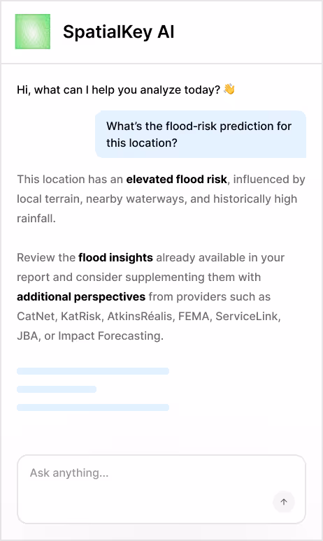
Turn complex analysis into clear answers
AI simplifies advanced geospatial modeling into insights underwriters and portfolio teams can act on immediately without needing specialized expertise
Scale insights across the organization
Make geospatial intelligence accessible across underwriting, portfolio, and claims teams so decisions aren’t limited by scarce technical resources
Accelerate deployment with AI-ready workflows
Get started quickly with AI-driven workflows designed to reduce implementation effort and minimize reliance on IT teams

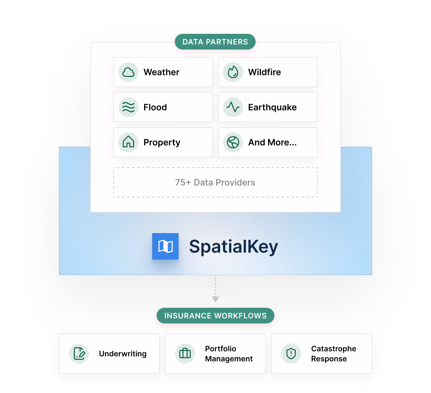
Access 75+ trusted data partners through a single platform
SpatialKey connects you directly to over 75 trusted property, hazard, and weather data providers within a single, unified ecosystem. Leverage centralized intelligence to drive underwriting resiliency, accelerate claims response times, and optimize portfolio management across your entire book of business.
More features
With SpatialKey, you get even more capabilities that make day-to-day operations more efficient and scale with your growth.

Speed-to-integrate – from login to live in minutes
Drag, drop, done – bring your data as-is – no rigid data format required
Large, worldwide interconnected data marketplace with 70+ integrated providers
Automated event notifications triggered by your custom settings
Historical event catalog for trends and benchmarking
Portfolio impact insights – location and policy-level calculations
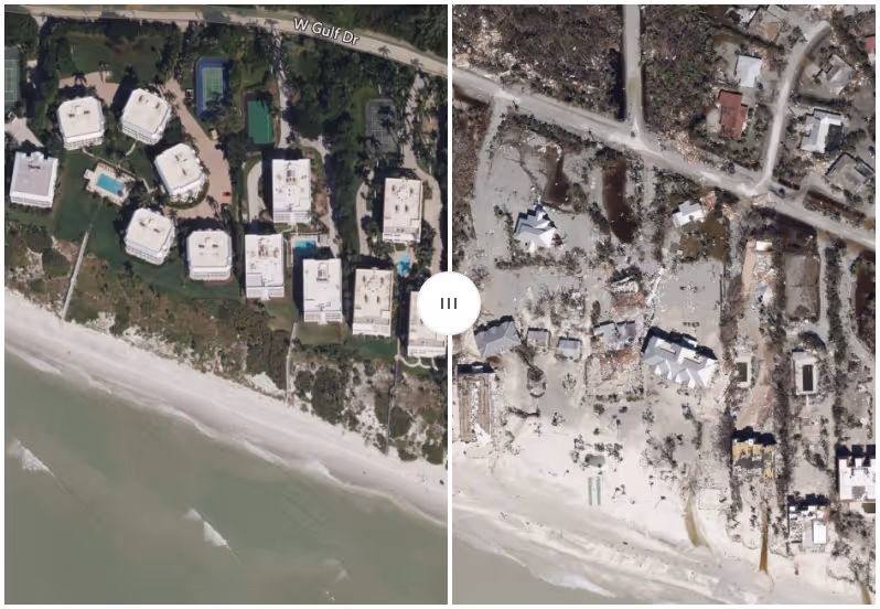
High-resolution pre and post-event imagery
Configurable rules engine with active event-impact moratoriums

What SpatialKey customers
are saying
“SpatialKey is an amazing underwriting tool because as our underwriters are evaluating a risk, they can pull up and see what other risks we have in the area. Maybe we have too much concentration in the area or maybe we don't have any. It's fabulous for seeing if we want to make an underwriting decision based on what other risk we have already written in the area.”


“As a startup, we needed geospatial analytics to be a part of our offering because it’s a necessity. We did an evaluation of al the providers out there and ended up choosing SpatialKey because of its proven track record, ease of use, flexibility, event response capabilities, and the ad hoc reporting."


“Unlike other carriers that wait for claims to come to them, Acuity hits the ground running thanks to our advanced technology [powered by Insurity’s SpatialKey]. We immediately triage claims, deploy our claim resources, coordinate with repair resources, and help people put their lives and businesses back together.”


“With SpatialKey, we can offer our clients unprecedented access to the right data at the right time to manage their response to catastrophes. Insurity’s intuitive, purpose-built applications and compelling visual analytics help us deliver business-critical event intelligence in moments. We look forward to many breakthroughs in insurance analytics with Insurity.”


“Data analytics is a key differentiator in how we operate, compete, select risks, and proactively manage our portfolio. With SpatialKey, we have empowered our underwriters and analytics team with actionable information to improve risk selection and portfolio performance.”


“[SpatialKey] helps us assess and present aggregate risk in a far more visually compelling way. Its speed, interactivity, and ability to handle large data sets enable us to work faster with greater flexibility.”


Resources


Book a demo
Ready to see SpatialKey in action? Step inside the platform with a demo tailored to your business priorities.